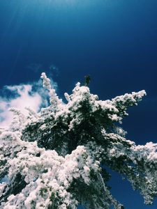
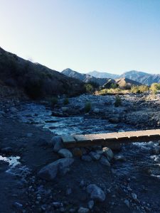
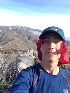
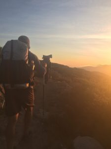
 Right outside of the town of Wrightwood lays Mount Baden Powel, a mountain named after the founder of Boy Scouts. While in town a snowstorm passed over, but it left its mark.
 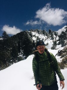 As I ascended the mountain small patches of snow grew into large massive blankets of snow. Miles were spent following nothing but the footprints of those who have gone before me. It took a full twenty mile day to escape the snow, but eventually I was able to set up camp on dry ground. These early encounters with snow are hopefully preparing me for the snow covered Sierras I will go through in a few weeks. -Noel Nelson
From Bad to Worse
After my thirty eight mile day, I set up camp at the first open place I saw. It was on a ridge about fifty feet above the valley floor. I laid down to sleep with good weather and a belly full of McDonald’s, but my sleep was cut short. Two hours after crawling into my tent the wind picked up. Then it started to rain. Then the wind picked up even more. Eventually the wind and rain were so strong, water was getting blown into my tent from the side. That is, when my tent was still standing. About every hour a gust of wind would be so strong that it would blow my tent completely over and I would have to fix it, trying to not get soaked in the process. This made for a long night with sleep nowhere to be found.
In the morning the rain let up but the wind had blown a fog in that was so thick, visibility was about twenty feet. So I threw all my stuff into my backpack and started walking. My next resupply location was in Wrightwood, about twenty five miles from where I slept. As I trudged toward my goals I got word that a snow storm was coming in and temps would be in the low twenties. Having already suffered through a few chilly nights I knew that was not something I wanted to take on. Upon arrival to Wrightwood some hikers offered to let me sleep in a cabin they rented. Instead of paying $60 for a hotel room I could pay $20 for a cabin. Things were looking up, that is until I looked down at my wallet. In the chaos of the night hike and storm I had lost my debit card….
I had $40 in cash but that would only cover my room for the next two nights and I was out of food. A sort of panic sunk in as I tried to think of the logistics of getting money and a new card. All while moving from day to day. After a few deep breaths I figured out how to get a new card but that would take a week. That’s a week without money or food. I felt like I was getting knocked down, standing back up to only get hit again.
After seeing my struggle, my hiking buddy Harry offered to loan me money until my card arrived. A true blessing. So I was able to buy food and if all goes will I will be able to support myself again soon enough.
I think having rough days is part of the process. The uncertainty of it all is what makes it an adventure. Although horrible in the moment, these are the events in life we look back on and laugh about. So for now I continue on my path to Canada, taking each day as it comes. -Noel Nelson
The Big Push
Up to this point, my mileage each day had been steadily growing. I started with 15 mile days and slowly work my way up to 20 mile days and eventually even did a few 25 milers. I never thought the morning I woke up at the hot spring, I would do my longest day yet. by a lot….
From the hot spring, interstate I-15 was about 35 miles ahead. At this highway a McDonald’s is located near the trail. This is a big deal for hikers struggling with “hiker hunger”. My original plan for the day was to do 18 miles and stroll into McDonald’s the next day for lunch, except by lunch time, I had already hit the 18 mile mark. At that point I knew it was possible to make it all the way. So I went for it. Along the way there were incredible vistas and I had good company.
 Finally, at around 8 pm the golden arches were in sight. I’ve never been a true McDonald’s fan but I can say that moment was different. I went in and ordered a double quarter pounder with cheese, a large fry, large drink, and twenty nuggets. I finished them all.
After dinner we ended up having to walk another three miles in the dark to find a campsite.That made for a 38 mile day. I set up my tent and went to sleep happy and full. All was well, or so I thought… -Noel Nelson
My First Zero
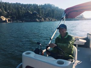
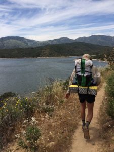
While on a thru hike, a “zero” is a day you don’t hike at all. I originally planned to take very few, if any, zeros but after a few hundred miles and two weeks of sleeping on the ground,my body vetoed my original plan. Luckily the next town I would reach would be Big Bear and it just so happened that our family friend and comedy writing legend Mike Rotman (Southpark, The Tonight Show, Politically Incorrect), owns a cabin there. After talking to him I realized that if I could make it from Idlewild to Big Bear in four days, the cabin would be unrented and I could stay there! The only problem is, that would mean I would have to average 25 miles per day for four days straight. That’s longer than I had backpacked in a day this entire trip continuously for four days. Although difficult, a warm bed and shower were all the motivation I needed to make it there on time. After four brutal days of backpacking I finally reached Big Bear and was able to take my first zero of the trail. The cabin and even the town were everything I dreamed of and I was able to spend the day going to a farmers market and boating on lake Big Bear. Early tomorrow it’s right back to the trail but now I am refreshed and ready to conquer the rest of the PCT. -Noel Nelson (mile 266)
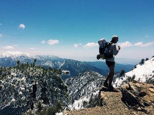
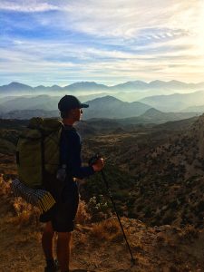
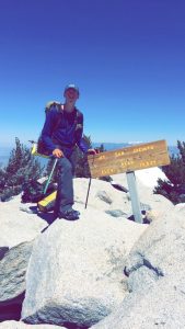
Mt. San Jacinto
I was told this was a high snow year for the west coast but I had no idea how much snow I would encounter this early into my journey.
When my alarm went off at 4:30 am I was already walking down the streets of Idlewild on my way to summit Mt. San Jacinto. In the first five miles alone I gained over 3,000 feet of elevation.
Once off the side trail leading from the town and back on the pct, I encountered my first bit of snow. It was a small patch about 2×2 ft. I didn’t think much of it but as I pressed on the snow patches grew in number and size. A few miles after reaching the pct I the trail was buried and I had to follow were the foot tracks of those who had gone before me.
While trudging through the snow I realized how slow it really was. I was moving at about one to one and a half miles per hour, half the speed I normally walk.
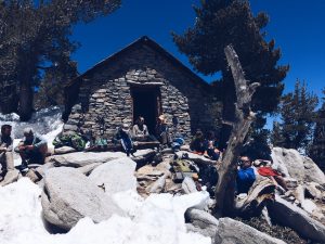
After three hours of steep uphill elevation gain without a trail I reached the storm shelter close to the top of the mountain. The stone hut made me feel as though I had stepped back in time. Although amazing, I still had to press on a few hundred more feet to the top of t
he mountain.
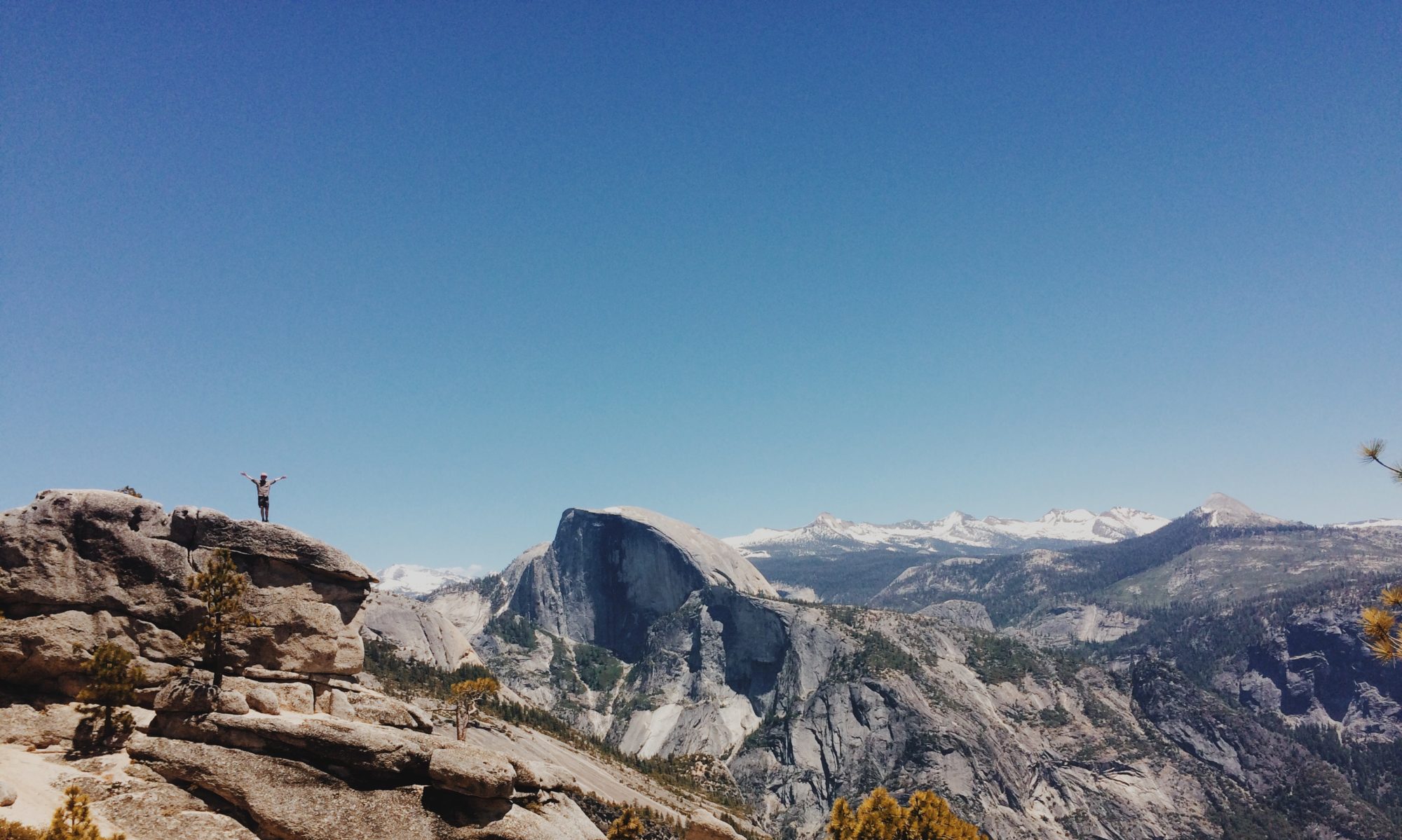
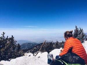
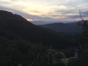
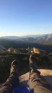
Finally, after hours of climbing I reached the top (10,834 ft above sea level). From this vantage point I was able to look across the desert and see how far I had traveled, as well as what laid before me.
My successful journey to the top was celebrated by eating my lunch with a view that most people only in pictures.
Although exhausting and time consuming, the feeling of accomplishment I got from climbing my first mountain in the PCT was enough to fuel my journey for the next couple days. Many people skipped the summit but I think going for it is the true nature of the trail. It is the nature of adventure.
Warner Springs to Idlewild
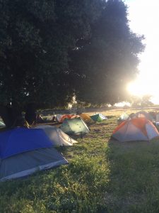
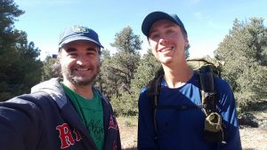
Warner Springs is a small town at mile 109. The community center there welcomes thru-hiker every year with food and let’s them camp out on their lawn. From there it is about 70 miles to a small town called Idlewild. During this 70 mile stretch I was able to hike with two guys from Israel. Both men had just gotten out of their required service in the armed forces and were on their celebratory vacation. By talking to them I was able to learn a lot about what it is like to live in Israel and a lot about the struggles they face as a country. A very interesting aspect of the trail is the diversity of people.
It is rare you feel like a minority in your own country but on the trail that seems to be the case. There are tons of people from Germany, Italy, Israel, Canada, and all over Europe. Talking to all the people has really given me insight into worlds I’ve never known about. After eating one of the best burgers of my life at Paradise Valley Cafe, I split up with them and headed back to the trail to hike the last 12 miles before the trail closes for a small section due to fire damage. Most people skip this 12 mile stretch in addition to the closer and hitch directly to Idlewild, but I figure I have the time so I chose to do it.
After the trail closed I took a side trail that led me all the way to Idlewild. In this small town I found a hostel type place that gives you a bunk and shower for $25 so I figured I’d sleep in a bed for a change. Tomorrow I will climb the San Jacinto Mt. My biggest test thus far. -Noel Nelson
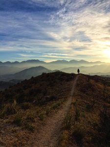
The First 100 Miles
Yesterday evening I passed the hundred mile mark. Generally a hundred mile backpacking trip is a long trip, but for me, passing this marker only made me realize how long of a trail this is. That may seem pessimistic but it’s the opposite. This first stretch has been incredible and I can’t wait to tackle the next twenty five hundred mile stretch.
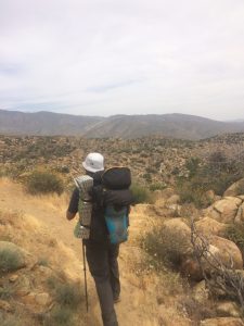
The Dessert and the Oasis
After camping in “the Boulders”, a beautiful campsite on top of a peak, the trail slowly descended 3,000 into a hot, dry desert floor. The long walk seemed to never end and water was nowhere to be found. After almost running out, I finally reached highway 78 and I was able to do my first hitch. In about 5 minutes of sticking my thumb out a girl stopped to pick up my new hiking partner Will and me. We were driven into the town of Julian and punished a burger. After taking a shower at an RV park it was back on the trail, covering a 10 mile dry stretch during sunset. Tomorrow I will pass mile 100. Even though I’ve only been out here a few days, it feels like months (in a good way). -Noel Nelson
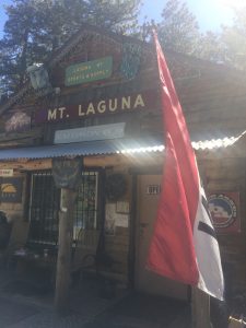
Mt Laguna
I originally planned to make it to Mt Laguna (mile 43) on the end of my fourth day, but I have been going faster than expected. I strolled in this morning around 8:45 am. Even though it is a small town, there is an outdoors store here that is famous for their “shakedown”. For most people this is necessary and they lose lots of pack weight. For me, it was only annoying and they tried to sell me on every single thing they had in stock. I plan to spend some time here and take off this afternoon for some cooler hiking. All in all, the trail is great so far.