Northern California

Natures balance beam

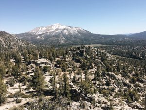
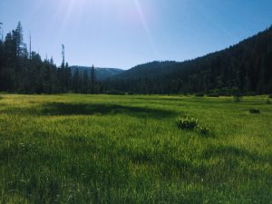
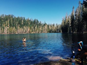
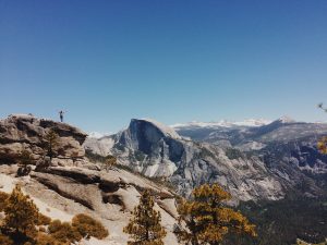
The PCT is broken up into five distinct sections. The desert, the sierras, northern California, Oregon, and Washington. As of now, I am in the heart of northern Cali. What makes this section unique is the massive pine tree forests and the easy grade of the trail. Compared to the heat of the desert and snow of the mountains, this change is welcomed with a happy heart. I am able to do as many miles per day as I did in the desert and the scenery is beautiful and new. Another thing that makes this section so nice is the abundance of towns along the way. Almost every day I am able to eat a meal at a resort or ranch.

meadow by Drakesbad guest ranch

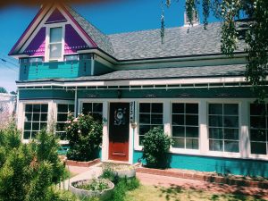
The day after leaving the town of Chester, I reached Drakesbad guest ranch. This is a rustic yet luxurious ranch nestled in Lassen National Park.  The ranch is not exactly fond of hikers, but with the purchase of a rather expensive dinner they allow you to use their facilities. So upon arriving I was able to shower and swim in the heated pool. After the regular guests eat the hikers were allowed to eat. A few of the hikers were promised vegan or gluten free meals so when the waiter brought out one platter of corn dogs and chicken strips we were frustrated at best. They explained that they had run out of food from serving their guests and at that point the guest who couldn’t eat any of the food stormed off in anger. The combination of paying 20$ for dinner and hiker hunger is enough to make anyone mad. Luckily they didn’t charge anyone and appologized for the inconvenience. So I left feeling pretty good about getting a free afternoon at an expensive guest ranch.

A quick dip in Lower Twin Lake

Additionaly, the section I’m backpacking now is the section I did as a PCT practice hike last summer. When our family friend Jim Plant backpacked the trail last summer I flew out and backpacked with him to get a taste of the trail. I had an amazing experience and being able to make it back to the same place is awesome. The trail hasn’t changed one bit but the experience is entirely new for me. I have changed. Not only is the hiking physically easier than last year but I am now fully in the thru-hiking community. I know just about every fellow hiker I pass. Seeing how far i’ve come has been amazing and there is still a lot of trail left for growth.

Noel Nelson (PCT mile 1371)

Back on Trail


Getting dropped off at Donner Pass by Hummingbirds parents

After our trip to Hummingbird’s cabin and yosemite, her parents drove us up to Donner Pass, near Truckee, CA. Because of the long drive from the cabin we didn’t arrive until 7pm. We walked a few miles and found an amazing spot overlooking the valley and a lake below us. We weren’t the only ones who had found this spot though. A few rock climbers were having a late night bouldering sesh about 50 ft from where we set up. After noticing us, they invited us over to hangout with them as they climbed. The night was spent telling stories and talking about future travel plans. One of the guys turned out to be a really awesome photographer. You check out us stuff on instagram by looking up “thehappycamper”. The next day we started back with true backpacking. Even this far out of the Sierras snow was still plentiful. The reason we bounced ahead was to avoid dangerous river crossings and this part of our plan was successful. Despite the slow going, I never once had to ford any rivers.

After trudging through snow for the better part of a day we came to “Peter Grub Hut”, a backcountry ski cabin. The first floor’s entrance was completely blocked by snow but there was a ladder to the second story door so we were able to enter. In the cabin we took our lunch break and had a jam sesh on a guitar left there.

Backcountry Ski Cabin

After our break we hiked the rest of the day eventually camping on dry ground. The next day we dropped in elevation and were able to walk on snow free trail for the first time in weeks. This made me so happy I cannot describe. Additionally, that night I was able to cowboy camp under the stars again. Things seemed to be back to normal. Early on the third morning after starting from Donner Pass we crossed a road leading to Sierra City. Because I knew I would be short on food, Prince, Nick, and I decided to head into town while Hummingbird and Lone Wolf continued on. In town I was able to not only resupply but also eat a burger called The Gut Buster. This burger with a full pound of meat definitely lived up to its name and we all headed back to the trail full and happy to be walking on dry ground once again.

Backpacking on Trail!!

Side Note: I love hearing from everyone in the comments! It makes me so happy to see people are not only reading about my adventures, but enjoying them! Sadly, I cannot respond to comments because I am updating my site from a phone. But nevertheless, let me know what you think!

Noel Nelson (pct mile 1195)

Road Trip to Yosemite

View of half dome

Once the decision to flip flop was made, a girl in our group asked her parents to drive up from their home in San Diego and drive us up north. They said yes and as a cherry on top, they allowed us to stay at their cabin for a few days. The cabin is located in the tiny town of Strawberry. With a population of 86, Strawberry is a summer vacation destination, full of camp sites and cabins by the lake. The best part of this town is it’s close proximity to Yosemite National Park.

Shortly after arriving in the cabin we set off to explore the local lake and hiked to a waterfall. The water was freezing but that didn’t stop us from attempting to swim.

Yosemite falls

The rest of the day was spent napping and playing card games.

On day two we woke up early and headed out toward Yosemite. As we drove into the park I felt as though I had entered another world. The giant cliff faces and water falls seemed too grand to be real. Once in the valley we decided on the Yosemite Falls hike. This is a seven mile round trip

On top of yosemite falls

hike with about 5,400 feet of elevation change. The description of the hike said “extremely strenuous” and estimated a travel time of 8 hours. Thanks to our hiker legs my group spent only three hours walking up and down the falls. Even though the actual hiking was quick, on top of the falls we took a lunch/photo shoot/nap break that lasted most of the afternoon.


After reluctantly ending the hike, we loaded back into the car and drove to Glacier Point. From this lookout you could see straight down the valley. Everywhere you looked, giant waterfalls viciously threw water over their edges and “ginormous” cliff faces leaned aggressively over the valley floor. Even with the many tourists the beauty of the valley made me feel very small and alone. I could have spent weeks exploring the valley but by 8 pm we were headed back to the cabin.

After the Yosemite trip it’s back to the trail. We are starting at Truckee (trail mile 1153 and 350 miles ahead of where we left off) today and it’s back to the grind. There will still be snow, but we won’t have the dangerous mountain passes and rivers to cross. I am looking forward to being able to fully enjoy the trail without worry about safety all the time.
-Noel Nelson (pct mile 1153

Flip Flopping

After staying in Bishop for a few days my group headed back to the trail. Once we got there we encountered a group headed back down the mountain. This group went in before us and turned back due to dangerous conditions. The group was made up of experienced thru hikers so their decisions to turn around was an eye opener. Already this year multiple thru-hikers have been swept away in the river and almost died. The snowmelt has turned what are normally small streams  into raging rivers.

At this point my gut told me not to go ahead. I almost never have gut feelings but I when I do, I listen to them. So I told my group I wouldn’t be going on. The next morning I woke up and they were gone. I packed up my stuff and when I got back to the parking lot, they were there. One person in the group got sick, so between that and my choice, they turned back. I was super surprised and happy to see them because I thought we had split up for good.

The Hostel California

From there, we headed back to the hostel in Bishop and worked on a flip flop plan. Flip flopping is a technique where you skip a section of trail and come back to it when conditions improve. In our planning, we decided to go a cabin, owned by a girl in our group, for a few days and then skip up to Sierra City, about 350 miles ahead of where we are. From there we will hike all the way to Canada and then finish with the section we are skipping. It makes me very sad to break up the continuous footpath from Mexico to Canada but I can’t justify the risk of continuing. I want to be around for many more years so I am swallowing my pride and bouncing up. -Noel Nelson (Bishop, CA)

Into the Mountains

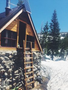
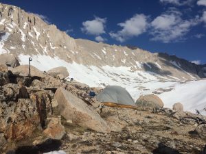
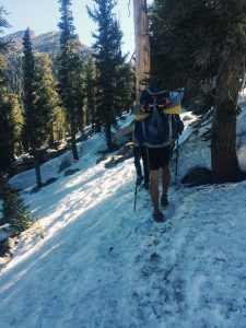
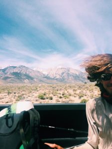
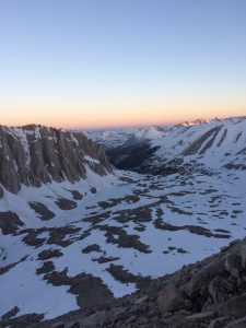
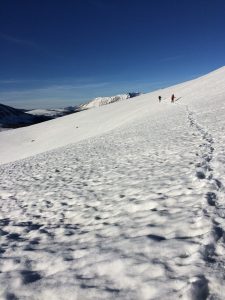
  1. After leaving Lone Pine, the nature of the trail changed. In my first stretch of the Sierra’s there would be patchy snow above 9,500 ft and the passes would be about 10,000 ft tall. After that you would walk miles on hard ground. As soon as we left Lone Pine it was nothing but snow. All day you’re walking on nothing but snow. In order to be able to get any mileage in I would wake up around 3am and “get walking” because by noon the snow would be slushy and walking nearly impossible. Additionally, the passes changed from being 10,000 feet to being 12,000-13,000 feet which meant big climbs on the snow. So the goal for pretty much every day is to wake up and make it over the pass early, then get as close to the next pass as possible and camp. This strategy makes for 10-15 miles days. The rest of the day is spent drying out clothes and resting.
A delicious camp meal!

One of the highlights of the whole trail is climbing Mt Whitney. At 14,505 ft tall this is the tallest mountain in the continental US. It was a 17 mile round trip side trail to summit. Although many people skip it, for my group that was never even considered. I made it about 4 miles on the side trail after 10 miles of pct and camped at Guitar Lake. Guitar Lake was almost completely frozen and staggering mountains surrounded me in every direction. My friend Harry got a fishing pole at the last town and we spent the afternoon fishing for the golden trout that live in the area. The pole worked great and we caught two fish that were big enough to eat. 
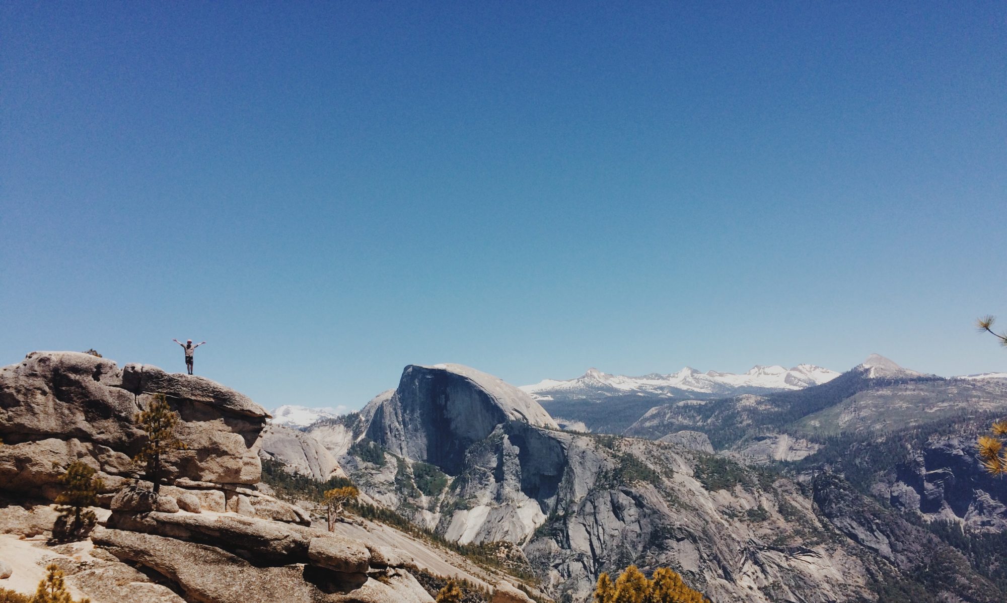
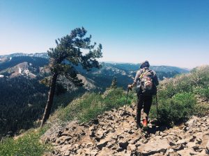
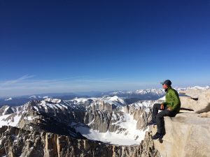
That night we feasted on rice and fish, with our minds on the mountain we would climb tomorrow. At 3 am our alarms rang and soon after we were on our way. After over 3,000 feet of climbing on snow we reached the top and jumped on the elevation marker. The view was spectacular and we spent the morning eating candy and looking at the snow covered mountains.

After a few hours we headed back down and pushed on toward camp. The next days were spent navigating water crossings and climbing passes. The final obstacle between me and my next town was Forester Pass. At 13,000 ft this pass is the highest on the entire trail. Not only that, but close to the top is an ice chute that goes down thousands of feet. Just like before, I woke up early and trudged toward the pass. Following footprints in the snow, I was able to make it up and over.

Mountain campsite

It would be all downhill from here (literally). The hard parts of this section were over. It took two more days of walking but we eventually made it out of the Sierra’s and down into the town of Bishop. After that section I am taking three zero days to let my mind and body rest before I head back into the mountains. This section is the hardest, but the beauty is more than enough reward.

-Noel Nelson (pct mile 788)

Entering the High Sierra’s

Sierra’s
Prince Crossing a Bridge

The final stop before the Sierra’s is Kennedy Meadows. From this point on the trail changes drastically. After arriving, I went to pick up the boxes I had shipped to myself and a box my family had shipped. In the four boxes was an ice axe, bear canister, new warmer sleeping bag. The final box had food. After packing everything up, my bag felt like it weighed a thousand pounds. Right before we left, a hiker from Denmark called Price joined Harry and me. The three of us headed out ready for this new and exciting section.

Snow Travel over a Pass

As we walked the trail steadily gained elevation for an entire day, we climbed from 6,000 to 10,000 feet very quickly. Even though the hiking was difficult, I was happily distracted by the beautiful scenery that was around every corner. We celebrated our first day in this section, by making a fire at camp that night (a surprisingly rare thing on the pct). The next two days I climbed up and over two peaks. The first was right around the 10,000 foot mark and the second, closer to 11,000 ft. Each peak had snow on the top but it was easy to walk over and I didn’t even need my snow gear.


After the second pass,

Hitch into Lone Pine

I took a side trail and descended to a park, where my group hitched a ride into the town of Lone Pine. The ride down was the scariest hitch of my life. Not because the people were sketchy, but because I rode in the back of a pickup truck down a mountain road with a major drop off on one side. Luckily I made it down alive and am now preparing for the next section. The next stretch will be one of the hardest. I will climb Mt Whitney and go over the highest pass on the entire trail. Additionally the snow will be a major factor and cut my daily mileage down drastically. Even with all this I am excited for the adventures to come.


-Noel Nelson (pct mile 744)

Bye Bye Desert

After a few days of rafting it was back to Walker Pass, where I left off. In order to make sure I got back on trail, my group left after dinner and didn’t get back to the trail until around 10 pm. There weren’t any campsites for a while so I ended up walking a few miles and gaining over a thousand feet of elevation in the dark. Once I finally got to a camp, I passed out without even setting up the tent. The next morning Harry and I said goodbye to our dutch friends and hiked on toward our next stop, Kennedy Meadows. It was only about fifty miles from where we got off to KM but I tried to enjoy every one of them because this was my last stretch in the desert. I had walked over 650 miles and even though there were brief moments in the snow and trees the majority was in the desert. That would soon be behind me though.

The last fifty miles flew by with my thoughts on all the amazing things I’ve seen so far and how the trail would only get better. The next section would be the high sierra’s, a complete opposite of what I had come from. I would leave the sandy deserts behind and move on to snowy mountains. As I walked my mind raced through all these thoughts. I was so deep in thought actually, that as I was walked down the trail, my eyes on the ground, I almost didn’t notice a bear right on the trail in front of me. It wasn’t until I was about 20 feet away from it that I looked up and froze in my tracks. I never expected to see a bear this far south and it took me by complete surprise. The bear didn’t seem to mind me though and after a few seconds, he slowly walked the other way.

After that incident nothing exciting happened, and the next day I reached Kennedy Meadows. From this point on the trail would be completely different. It was goodbye desert, hello snow.        -Noel Nelson (pct mile 702)